Posts

Showing posts with the label Prehistoric Landscapes

Top Places to visit in Northern Argentina

Image
Argentina is known for its stunning and varied landscape. But in Northern Argentina, the landscape becomes more dramatic and also more colourful. Most of the landscape is composed by desert, valleys, hills and mountains. The colourful landscape is the product of a complex geological activity that started around 600 million years ago when the area was still under water. The different colours of sedimentary layers that compose the mountains and hills have been formed during different time periods. The rocks with shades of green are believed to be the oldest ones. Here we have listed four jaw-dropping places that are unmissable in Northern Argentina. FOURTEEN COLOURED MOUNTAIN (SERRANIA DE HORNOCAL) The Fourteen Coloured Mountain is a limestone formation called Yacoraite which is a largely Mesozoic geologic formation. The mountain is mainly composed of rock outcrops from different time periods and it was created between 130 and 65 million years ago. Dinosaur remains and other fossils have
The Land of Sarsen Stones

Image
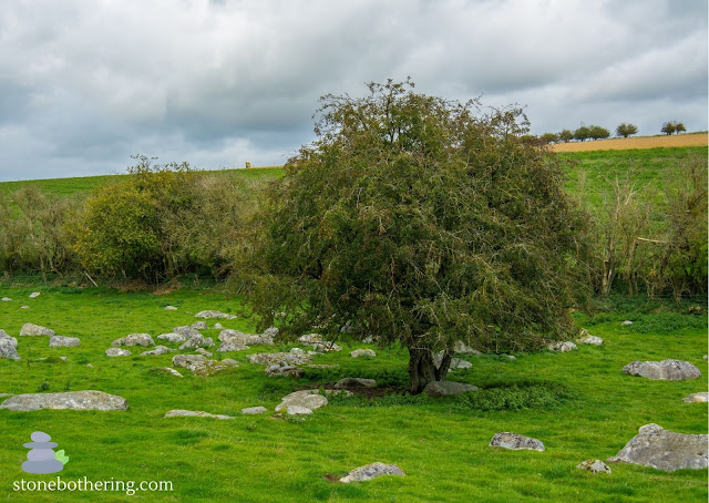
Sarsen stones are sedimentary rocks mostly made up of quartz sand cemented by silica. The stones are found mostly across England, being Wiltshire the county with the largest amount of these stones. It's believed that they were moved to the area through glacial action during the ice age, around 5 to 10 million years ago. Sarsen stones were used in the construction of ancient monument such as Stonehenge and Avebury Stone Circles. But they can also be found scattered naturally across fields. In this post we list 5 places with large amounts of sarsen stones that can be visited in the county of Wiltshire. PIGGLEDENE Piggledene is probably the most famous site of its kind, containing a large amount of sarsen stones scattered across a field. This site is a remnant of a much larger landscape of sandstone periglacial deposits. Many of the stones have been removed in the past to provide building materials in the area. It's possible to see where the stones were worked, split and cut. It&#

Neolithic Polishing Stones (Polissoirs): A window into the past

Image
Neolithic polishing stones, also known as polissoirs, are large stones that were used by Neolithic people to sharpen and polish their stone tools, such as axes, adzes, and chisels. These stones are typically made of hard, durable materials such as sandstone, granite, or quartzite. They often have a smooth, concave surface that was created by repeated use. Polissoirs are found all over the world, but they are particularly common in Europe and Asia. They are thought to have been used from around 10,000 to 5,000 years ago, during the Neolithic period. This was a time when humans were transitioning from a nomadic lifestyle to a more settled one, and they were developing new technologies, such as agriculture and pottery. Polishing stones were an essential tool for the Neolithic people. Sharp, polished stone tools were essential for felling trees, clearing land for farming, building houses, and making other tools and weapons. Polishing stones were also used to make ceremonial objects, such a

King Arthur's Cave

Image
King Arthur's Cave is a limestone cave with a double interconnected entrance and two main chambers located in an area of limestone cliffs that were formed 345 million years ago. The caves in this area were cut into the rock by a river flowing along the base of the cliffs. Over time the river dissolved the limestone to form King Arthur's Cave and others. There is evidence that the cave was inhabited from the Upper Palaeolithic to the Bronze Age period. Bones found during excavations suggest that humans sat around a fire eating red deer about 12,000 years ago. Flint tools and pottery from the Neolithic period were also found in the cave. The cave was excavated in 1871 by Reverend William Symonds. He unearthed bones from lion, giant deer, hyena and bones of ice age animals like woolly rhinoceros, cave bear and woolly mammoth. In the Victorian Era the cave was known as Hyena's Den. It's unclear why its name was changed to King Arthur's Cave. The cave is located in a nat

Top Ancient Sites in Somerset

Image
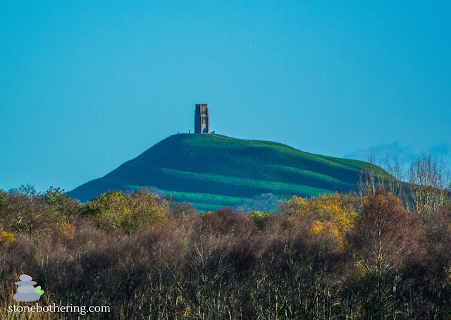
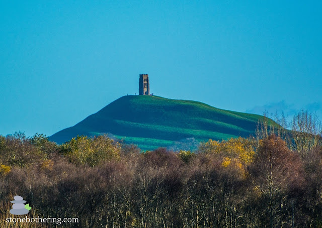
Somerset is a rural county in South West England, offering a wide range of prehistoric landscapes in addition to impressive ancient sites. The county has a long history of settlement and is known to have been settled from Palaeolithic times. It's steeped in history and folklore, making it the perfect place to explore England's past. Here is a list of the top ancient sites in this amazing county. GLASTONBURY TOR Glastonbury Tor is certainly one of the most iconic ancient sites in England. It's a hill with a 14th century tower on its top which is all that remains of St. Michael's Church. Glastonbury Tor is a conical hill that rises 158m above the Avalon Marshes. Its peculiar shape is due to a combination of the unusual geology and the distinctive terraces surrounding the hill. The top of the hill is formed from a succession of rocks assigned to the Bridport Sand Formation. These rocks sit upon clay and limestones deposited during the early Jurassic Period. Read more about

What is so special about Glastonbury Tor?

Image
Glastonbury Tor is certainly one of the most iconic ancient sites in England. It's a hill with a 14th century tower on its top which is all that remains of St. Michael's Church. Glastonbury Tor is a conical hill that rises 158m above the Avalon Marshes. Its peculiar shape is due to a combination of the unusual geology and the distinctive terraces surrounding the hill. The top of the hill is formed from a succession of rocks assigned to the Bridport Sand Formation. These rocks sit upon clay and limestones deposited during the early Jurassic Period. Geologists haven't found a plausible explanation on how the Tor has survived the erosion of the land around it, but it's believed that a nearby natural spring known as Chalice Well could have helped to prevent it. Chalice Well is an ancient spring nestled at the foot of the Glastonbury Tor. The spring flows from the ground and contains high levels of iron, which colours the water red . This water could have hardened an area of

Toachi River Canyon in Ecuador

Image
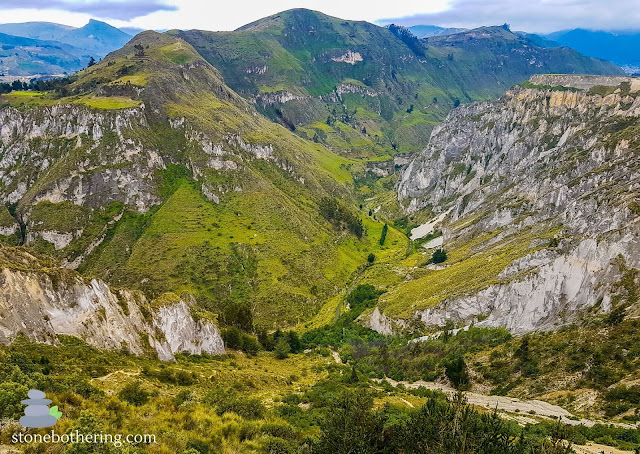
The Toachi River Canyon is a canyon located near the Quilotoa Volcano in Ecuador. It was created by the pyroclastic flows from the volcano's eruptions. The Toachi River Canyon has an average depth of around 40 meters but its highest point is around 100 meters deep. The base of the canyon is formed by volcanic bombs and small stones called lapilli which are rock fragments ejected from the nearby volcano. The canyon gets its name from the Toachi River that runs inside the canyon. The river is famous for its unique rafting conditions. Toachi River Canyon is a spectacular place to visit. It starts at the Quilotoa Volcano and eventually fades into the Andean landscape. The canyon is located in the Cotopaxi Province at an altitude of 3,860 meters above sea level. © All rights reserved

A Journey Trough the Odd Stones of Staunton

Image
Deep within the ancient emerald embrace of the Forest of Dean, nestled against the winding River Wye, lies the charming village of Staunton. But for those with a curious spirit and a taste for the mysterious, it's not just the picturesque cottages and idyllic landscapes that beckon. Staunton boasts a collection of fascinating stones, each whispering tales of forgotten times and intriguing the imagination. The Staunton Longstone is a sentinel of Old Red Conglomerate standing tall by the road. Erected in the Bronze Age, its purpose remains shrouded in mist. Was it a marker for travelers, a monument to the departed, or a focal point for rituals under the starlit sky? Local lore imbues it with a touch of the macabre, claiming it bleeds at the witching hour – a chilling legend guaranteed to send shivers down your spine. The Buckstone, a once-rocking behemoth, dislodged by revelers in 1885, now rests firmly cemented atop a hill. Climb its weathered surface and be rewarded with panoramic

Land's End and the Lost Land of Lyonesse

Image
Land's End, the dramatic, windswept tip of Cornwall, England, is a place where myth and geology intertwine. Legends whisper of Lyonesse, a kingdom swallowed by the sea, while the jagged cliffs reveal a story etched in ancient rock. A Land Forged by Fire and Ice: Imagine a time, 480 million years ago, when Cornwall lay submerged beneath a tropical sea. Volcanic eruptions spewed fiery ash, which over countless eons, compressed and metamorphosed into the dark slates and greenstones that dominate the cliffs today. Later, during the Ice Age, glaciers sculpted the landscape, leaving behind dramatic valleys and toweringtors. Witness these forces of nature at their most impressive at Longships Rock, a jagged island adorned with stripes of volcanic and sedimentary rock. Echoes of a Lost Kingdom: Legend paints a vivid picture of Lyonesse, a fertile land brimming with 140 churches and prosperous towns, tragically consumed by the ocean in a single night. While geological evidence doesn&

Unveiling the Mystery: Stone Secrets of the Nazca Lines

Image
The Nazca Lines, enigmatic geoglyphs etched into the Peruvian desert, have captivated imaginations for centuries. But one enduring question remains: how were they created? While the answer likely involves a combination of factors, the popular myth of "stone construction" deserves a closer look. Stones on the Surface: It's true that stones exist near the Nazca Lines. The desert floor is naturally covered with reddish-brown pebbles, contrasting with the lighter-colored sand beneath. However, these stones played no part in drawing the lines themselves. Instead, the Nazca people cleverly utilized the natural contrast. The True Technique: The Nazca Lines were created through a meticulous process of removing the top layer of pebbles, not adding stones. Using simple tools like digging sticks and stones, they meticulously cleared paths, revealing the lighter ground below. This painstaking work resulted in the intricate lines, geometric shapes, and iconic animal figures we see tod

West Woods and the Secrets of Stonehenge's Stones

Image
Hidden among the trees of Wiltshire, England, lies a woodland whispering tales of giants and ancient puzzles. West Woods, once an unassuming site, has shot to fame in recent years as the likely source of the colossal sarsen stones that make up Stonehenge, the iconic prehistoric monument. For centuries, the origin of these massive stones, weighing up to 25 tons, remained a mystery. Theories pointed to distant locations, with speculations ranging from Wales to even Africa. But in 2020, a scientific breakthrough changed everything. Geochemical analysis of a core drilled from a Stonehenge sarsen stone matched perfectly with samples from West Woods. This confirmed what many archaeologists had suspected for years: this unassuming woodland held the key to Stonehenge's construction. But West Woods is more than just a quarry. Evidence suggests it was a place of human activity long before the sarsens were extracted. Stone tools dating back to the Mesolithic period (7,000 - 4,000 BCE) have be

Unveiling the Mysteries of Arthur's Stone in Dorstone

Image
Nestled amidst the rolling hills of Herefordshire, England, lies a monument shrouded in legend and history - Arthur's Stone. This impressive Neolithic chambered tomb, dating back to a staggering 3, 700-2, 700 BC, whispers tales of ancient rituals and whispers of the mythical King Arthur. More than just massive stones, Arthur's Stone is a portal to a bygone era. As you approach, the sheer size of the capstone, weighing an estimated 25 tons, inspires awe. Imagine the immense effort it took our Neolithic ancestors to move and position these behemoths without the aid of modern machinery. The sight sparks curiosity: who built this tomb? What ceremonies were held within its chamber? What stories do these stones hold? While the answers remain locked in time, legends offer their own interpretations. The most famous links Arthur's Stone to the legendary King Arthur himself. Local folklore claims it was here that Arthur slayed a giant, leaving indentations of his e

A Geological Journey through the Valley of Rocks

Image
The Valley of Rocks, nestled in the heart of Exmoor National Park, England, is more than just a scenic wonder. It's a window into the Earth's ancient past, whispering tales of shifting continents, relentless seas, and the forces that shaped our planet. So, grab your metaphorical pickaxe and join me on a geological exploration of this captivating landscape. Rock Stars: The Lynton Formation Takes Center Stage The Valley's dramatic cliffs are composed of the Lynton Formation, some of the oldest Devonian rocks in North Devon. These fine-grained sandstones and slates, dating back a whopping 400 million years, hold a treasure trove of fossils. Brachiopods, trilobites, and even the remnants of early fish paint a vivid picture of a teeming marine environment that once existed here. The River's Mystery: A Geological Whodunnit One of the Valley's most intriguing features is its very existence. Why is it a dry valley, seemingly defying the logic of rivers flo